Caedes
Upload Images
Welcome guest
Log In or Register
User Stats
- 0 total users online
- 42 users active today
- 259254 total members
- +show users online
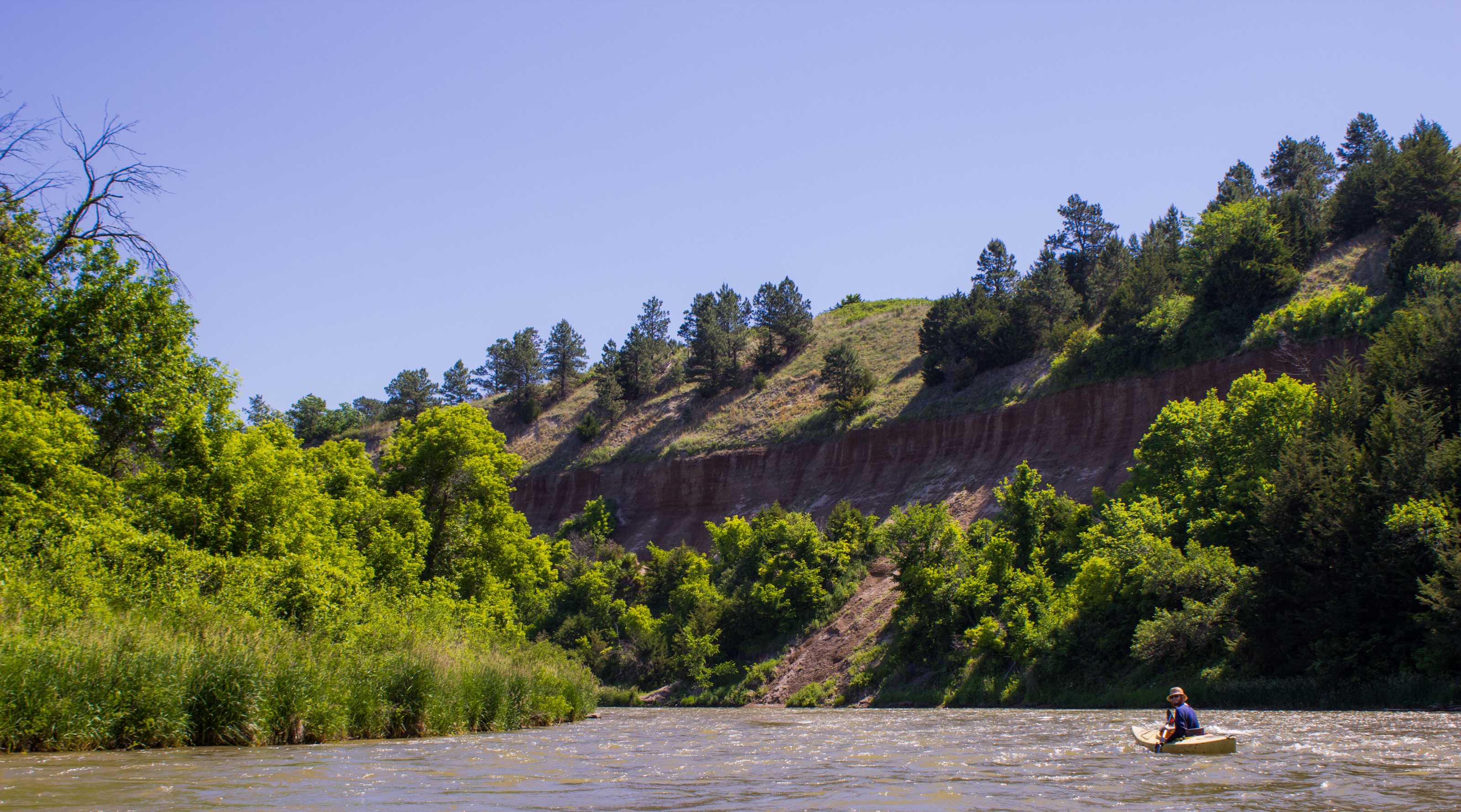
Niobrara River Valley
© Pistos
(copyright information)
Uploaded: 06/29/17 3:07 PM GMT
Niobrara River Valley
Views: 507
Dlds: 226
Status: active
Dlds: 226
Status: active
Gallery:
photography->landscape
The Niobrara flows through Nebraska's Sand Hill region. The name is appropriate because the ground here is mostly sand. You can tell by looking at the cliff face and seeing the sand piling up at the base of the cliff.
Comments
Post a Comment - Subscribe to this discussionNational Geographic sells a book titled "National Geographic Guide to Scenic Highways and Byways, 4th Edition: The 300 Best Drives in the U.S.". Each state is represented but not at all evenly; California has eleven, Nebraska only one, stretching from Gordon in the Northwest to Fort Robinson and then south to Agate Fossils Beds. That's a nice drive but somehow the editors and researchers overlooked the Sand Hills. Not surprising, considering what they chose for my state of ND and what they overlooked. Whatever the case, Jeff, your photo well represents this area with a view most can only see from a kayak, the best way to do it, in my estimation.
-Nik
-Nik
2∈
[?]
If you've ever wanted to make a difference but found it hard to believe that one person could... check out the Kiva Team Caedes discussion thread and discover that anything is possible.
tigs=^..^=